
 Pointe-à-la-Croix
Sainte-Irène, Quebec
Marsoui
Hecla
Muskrat Dam
Wunnummin Lake
Sainte-Brigitte-de-Laval
Drayton
Mauricie
Pointe-à-la-Croix
Sainte-Irène, Quebec
Marsoui
Hecla
Muskrat Dam
Wunnummin Lake
Sainte-Brigitte-de-Laval
Drayton
Mauricie
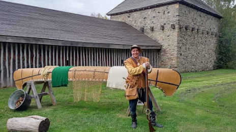
Sainte-Marie among the Hurons on the map, Midland, Canada
Photo
Where is located Sainte-Marie among the Hurons
Sainte-Marie among the Hurons — local attraction, which is located at 16164 ON-12, Midland, ON L4R 4K8, Canada and belongs to the category — history museum. Average visitor rating for this place — 4.6 (according to 693 ratings, information from open sources and relevant for 2022).
Exact location — Sainte-Marie among the Hurons, marked on the map with a red marker.
You can get directions to Sainte-Marie among the Hurons on the map from your location.
What else is interesting in Midland? You can see all the sights if you go to the city page.
Coordinates
Sainte-Marie among the Hurons, Canada coordinates in decimal format: latitude — 44.73382187113778, longitude — -79.844655375012. When converted to degrees, minutes, seconds Sainte-Marie among the Hurons has the following coordinates: 44°44′1.76 north latitude and -79°50′40.76 east longitude.
Nearby cities
The largest cities that are located nearby:
- Barrie — 43 km
- Richmond Hill — 102 km
- Vaughan — 105 km
- Markham — 108 km
- Brampton — 113 km
- Whitby — 121 km
- Oshawa — 125 km
- Toronto — 128 km
- Mississauga — 130 km
- Guelph — 136 km
- Oakville — 143 km
- Waterloo — 151 km
- Kitchener — 155 km
- Cambridge — 157 km
- Burlington — 158 km
- Hamilton — 166 km
- Saint Catharines — 183 km
- Amherst
 (United States) — 215 km
 - Buffalo (United States) — 222 km
Distance to the capital
Distance to the capital (Ottawa) is about — 335 km.