
 Warner Robins
Wantagh
Bethel
Misty Hill Farm
United States
Wakonda Beach (R33) Airport
Wilmington
Poland
Miami International Airport
Warner Robins
Wantagh
Bethel
Misty Hill Farm
United States
Wakonda Beach (R33) Airport
Wilmington
Poland
Miami International Airport
Batia Vineyards on the map, El Dorado Hills, United States
Photo
Where is located Batia Vineyards
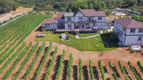
Batia Vineyards — local attraction, which is located at 1240 Deer Creek Rd, Cameron Park, CA 95682, United States and belongs to the category — vineyard. Average visitor rating for this place — 5.0 (according to 7 ratings, information from open sources and relevant for 2022).
Exact location — Batia Vineyards, marked on the map with a red marker.
You can get directions to Batia Vineyards on the map from your location.
What else is interesting in El Dorado Hills? You can see all the sights if you go to the city page.
Coordinates
Batia Vineyards, United States coordinates in decimal format: latitude — 38.641029269578056, longitude — -120.9912103751078. When converted to degrees, minutes, seconds Batia Vineyards has the following coordinates: 38°38′27.71 north latitude and -120°59′28.36 east longitude.
Nearby cities
The largest cities that are located nearby:
- Roseville — 19 km
- Sacramento — 37 km
- Stockton — 83 km
- Fairfield — 96 km
- Concord — 114 km
- Modesto — 116 km
- Vallejo — 121 km
- Berkeley — 137 km
- Richmond — 140 km
- Hayward — 142 km
- Oakland — 142 km
- Reno — 143 km
- Santa Rosa — 144 km
- Fremont — 149 km
- San Francisco — 154 km
- San Jose — 165 km
- Santa Clara — 166 km
- Sunnyvale — 168 km
- Salinas — 228 km
Distance to the capital
Distance to the capital (Washington) is about — 3774 km.