Grayville — Bonita
Grayville — Apache Junction
Grayville — Basalt
Grayville — Beaufort
Grayville — Hernando County
Grayville — Frakes
Grayville — Oak Forest
Grayville — Florence
Grayville — Murdock
Grayville — Evart
Grayville — Mount Orab
Grayville — East Earl
Grayville — Lincoln
Grayville — Canastota
Grayville — Ahsahka
Grayville — Coggon
Grayville — Beech Grove
Grayville — Villa Hills
Grayville — Havertown
Mill Shoals
Barnhill
Keenes
Bluford
Opdyke
Bonnie
Richview
Hoyleton
Okawville
New Baden
Mascoutah
Shiloh
Fairview Heights
Caseyville
East Saint Louis
St. Louis
Granite City
St. Louis
St. Louis Lambert International Airport
Bridgeton
Maryland Heights
Earth City
Saint Charles
Saint Peters
O'Fallon
Lake Saint Louis
Wentzville
Foristell
Wright City
Truesdale
Warrenton
Jonesburg
New Florence
Kingdom City
Columbia
Rocheport
Lamine Township
Blackwater
Sweet Springs
Emma
Mayview
Bates City
Grain Valley
Blue Springs
Independence
Independence
Independence
North Kansas City
Gladstone
Clay County
Kansas City
Kansas City International Airport
Kansas City International Airport
Platte City
Camden Point
Faucett
Buchanan County
St. Joseph
Amazonia
Rock Port
Nebraska City
Dallas
Otoe
Syracuse
Palmyra
Lincoln
Lincoln
Pleasant Dale
Beaver Crossing
York
Aurora
Giltner
Alda
Gibbon
Kearney
Lexington
Cozad
Gothenburg
North Platte
Hershey
Ogallala
Julesburg
Chappell
Lodgepole
Kimball
Cheyenne
Laramie
Elk Mountain
Sinclair
Rawlins
Rock Springs
Lyman
Fort Bridger
Coalville
Park City
Holladay
Salt Lake City
Salt Lake City
Red Lion-Sheraton Hotel Heliport
Magna
Wendover
West Wendover
Wells
Halleck
Elko
Carlin
Battle Mountain
Winnemucca
Imlay
Lovelock
Fernley
Sparks
Reno
Floriston
Truckee
Eder
Norden
Soda Springs
Gold Run
Cape Horn
Colfax
Weimar
Meadow Vista
Auburn
Newcastle
Rocklin
Roseville
Citrus Heights
North Highlands
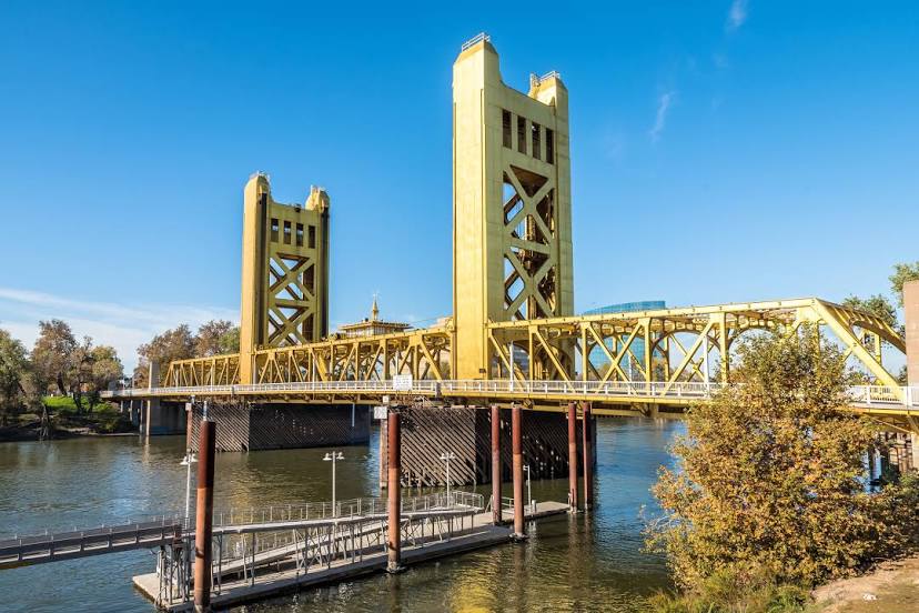
Sacramento
Grayville — Bonita
Grayville — Apache Junction
Grayville — Basalt
Grayville — Beaufort
Grayville — Hernando County
Grayville — Frakes
Grayville — Oak Forest
Grayville — Florence
Grayville — Murdock
Grayville — Evart
Grayville — Mount Orab
Grayville — East Earl
Grayville — Lincoln
Grayville — Canastota
Grayville — Ahsahka
Grayville — Coggon
Grayville — Beech Grove
Grayville — Villa Hills
Grayville — Havertown
Mill Shoals
Barnhill
Keenes
Bluford
Opdyke
Bonnie
Richview
Hoyleton
Okawville
New Baden
Mascoutah
Shiloh
Fairview Heights
Caseyville
East Saint Louis
St. Louis
Granite City
St. Louis
St. Louis Lambert International Airport
Bridgeton
Maryland Heights
Earth City
Saint Charles
Saint Peters
O'Fallon
Lake Saint Louis
Wentzville
Foristell
Wright City
Truesdale
Warrenton
Jonesburg
New Florence
Kingdom City
Columbia
Rocheport
Lamine Township
Blackwater
Sweet Springs
Emma
Mayview
Bates City
Grain Valley
Blue Springs
Independence
Independence
Independence
North Kansas City
Gladstone
Clay County
Kansas City
Kansas City International Airport
Kansas City International Airport
Platte City
Camden Point
Faucett
Buchanan County
St. Joseph
Amazonia
Rock Port
Nebraska City
Dallas
Otoe
Syracuse
Palmyra
Lincoln
Lincoln
Pleasant Dale
Beaver Crossing
York
Aurora
Giltner
Alda
Gibbon
Kearney
Lexington
Cozad
Gothenburg
North Platte
Hershey
Ogallala
Julesburg
Chappell
Lodgepole
Kimball
Cheyenne
Laramie
Elk Mountain
Sinclair
Rawlins
Rock Springs
Lyman
Fort Bridger
Coalville
Park City
Holladay
Salt Lake City
Salt Lake City
Red Lion-Sheraton Hotel Heliport
Magna
Wendover
West Wendover
Wells
Halleck
Elko
Carlin
Battle Mountain
Winnemucca
Imlay
Lovelock
Fernley
Sparks
Reno
Floriston
Truckee
Eder
Norden
Soda Springs
Gold Run
Cape Horn
Colfax
Weimar
Meadow Vista
Auburn
Newcastle
Rocklin
Roseville
Citrus Heights
North Highlands
Sacramento
Grayville — West Sacramento distance, route on the map
Distance by car
Distance between Grayville, Illinois, United States and West Sacramento, California, United States by car is — km, or miles. To travel this distance by car, you need minute, or h.
Route on the map, driving directions
Car route Grayville — West Sacramento was created automatically. The road on the map is shown as a blue line. By moving the markers, you can create a new route through the points you need.
Passing cities through which the car route passes: Burnt Prairie, Mill Shoals, Barnhill, Keenes, Bluford, Opdyke, Bonnie, Richview, Hoyleton, Okawville, New Baden, Mascoutah, Shiloh, Fairview Heights, Caseyville, East Saint Louis, St. Louis, Granite City, St. Louis, St. Louis Lambert International Airport, Bridgeton, Maryland Heights, Earth City, Saint Charles, Saint Peters, O'Fallon, Lake Saint Louis, Wentzville, Foristell, Wright City, Truesdale, Warrenton, Jonesburg, New Florence, Kingdom City, Columbia, Rocheport, Lamine Township, Blackwater, Sweet Springs, Emma, Mayview, Bates City, Grain Valley, Blue Springs, Independence, Independence, Independence, North Kansas City, Gladstone, Clay County, Kansas City, Kansas City International Airport, Kansas City International Airport, Platte City, Camden Point, Faucett, Buchanan County, St. Joseph, Amazonia, Rock Port, Nebraska City, Dallas, Otoe, Syracuse, Palmyra, Lincoln, Lincoln, Pleasant Dale, Beaver Crossing, York, Aurora, Giltner, Alda, Gibbon, Kearney, Lexington, Cozad, Gothenburg, North Platte, Hershey, Ogallala, Julesburg, Chappell, Lodgepole, Kimball, Cheyenne, Laramie, Elk Mountain, Sinclair, Rawlins, Rock Springs, Lyman, Fort Bridger, Coalville, Park City, Holladay, Salt Lake City, Salt Lake City, Red Lion-Sheraton Hotel Heliport, Magna, Wendover, West Wendover, Wells, Halleck, Elko, Carlin, Battle Mountain, Winnemucca, Imlay, Lovelock, Fernley, Sparks, Reno, Floriston, Truckee, Eder, Norden, Soda Springs, Gold Run, Cape Horn, Colfax, Weimar, Meadow Vista, Auburn, Newcastle, Rocklin, Roseville, Citrus Heights, North Highlands, Sacramento.
Distance by plane
If you decide to take a trip Grayville West Sacramento by plane, then you have to fly the distance — 2906 km or 1802 miles. It is marked on the map with a gray line (between two points in a straight line).
Flight time
Estimated flight time Grayville West Sacramento by plane at cruising speed 750 km / h will be — 3 h. and 52 min.
Direction of movement
United States, Grayville — right-hand traffic. United States, West Sacramento — right-hand traffic.
Difference in time
Grayville and West Sacramento are in different time zones. The time difference is 2 hours (UTC -5 America/Chicago, UTC -7 America/Los_Angeles).
Interesting Facts
Information on alternative ways to get to your destination.
The length of this distance is about 7.3% of the total length of the equator.
The percentage of the population is clearly shown in the graph:
Grayville — 1,634 (less by 39,812), West Sacramento — 41,446 residents.
The cost of travel
Calculate the cost of the trip yourself using the fuel consumption calculator, changing the data in the table.