Coleville — Orange
Coleville — Swallows
Coleville — Laceyville
Coleville — Pierpont
Coleville — Millsboro
Coleville — Mount Jackson
Coleville — Vulcan
Coleville — Melbourne
Coleville — Danube
Coleville — Edgefield
Coleville — Smoot
Coleville — Harrold
Coleville — La Marque
Coleville — Victorville
Coleville — Fola
Coleville — Concho
Coleville — Hatton
Coleville — Springfield
Coleville — Kasson
Lundy
Lee Vining
June Lake
Mammoth Lakes
Bishop
Independence
Lone Pine
Cartago
Olancha
Inyokern
Randsburg
Adelanto
Cajon Junction
Lytle Creek
Rialto
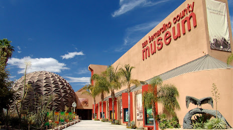
San Bernardino
Colton
Coleville — Orange
Coleville — Swallows
Coleville — Laceyville
Coleville — Pierpont
Coleville — Millsboro
Coleville — Mount Jackson
Coleville — Vulcan
Coleville — Melbourne
Coleville — Danube
Coleville — Edgefield
Coleville — Smoot
Coleville — Harrold
Coleville — La Marque
Coleville — Victorville
Coleville — Fola
Coleville — Concho
Coleville — Hatton
Coleville — Springfield
Coleville — Kasson
Lundy
Lee Vining
June Lake
Mammoth Lakes
Bishop
Independence
Lone Pine
Cartago
Olancha
Inyokern
Randsburg
Adelanto
Cajon Junction
Lytle Creek
Rialto
San Bernardino
Colton
Coleville — Loma Linda distance, route on the map
Distance by car
Distance between Coleville, California, United States and Loma Linda, California, United States by car is — km, or miles. To travel this distance by car, you need minute, or h.
Route on the map, driving directions
Car route Coleville — Loma Linda was created automatically. The road on the map is shown as a blue line. By moving the markers, you can create a new route through the points you need.
Passing cities through which the car route passes: Bridgeport, Lundy, Lee Vining, June Lake, Mammoth Lakes, Bishop, Independence, Lone Pine, Cartago, Olancha, Inyokern, Randsburg, Adelanto, Cajon Junction, Lytle Creek, Rialto, San Bernardino, Colton.
Distance by plane
If you decide to take a trip Coleville Loma Linda by plane, then you have to fly the distance — 541 km or 335 miles. It is marked on the map with a gray line (between two points in a straight line).
Flight time
Estimated flight time Coleville Loma Linda by plane at cruising speed 750 km / h will be — 43 min.
Direction of movement
United States, Coleville — right-hand traffic. United States, Loma Linda — right-hand traffic.
Difference in time
Coleville and Loma Linda are in the same time zone. Between them there is no time difference (UTC -7 America/Los_Angeles).
Interesting Facts
Information on alternative ways to get to your destination.
The length of this distance is about 1.3% of the total length of the equator.
The cost of travel
Calculate the cost of the trip yourself using the fuel consumption calculator, changing the data in the table.