Whitehorse — Three Hills
Whitehorse — Saint-Paul-de-Montminy
Whitehorse — Rivière-Rouge
Whitehorse — Gold Bridge
Whitehorse — Charlesbourg
Whitehorse — Le Bois-Clair
Whitehorse — McRae
Whitehorse — Sunnyside
Whitehorse — Yukon Territory
Whitehorse — La Romaine
Whitehorse — Prescott
Whitehorse — Parry Sound
Whitehorse — Echo Bay
Whitehorse — Esther
Whitehorse — Cascade
Whitehorse — Souris
Whitehorse — Coquitlam
Whitehorse — Canora
Whitehorse — Cow Bay
Teslin
Swift River
Watson Lake
Fort Nelson
Charlie Lake
Fort Saint John
Baldonnel
Taylor
Dawson Creek
Pouce Coupe
Demmitt
Hythe
Beaverlodge
Wembley
Clairmont
Calais
Valleyview
Whitecourt
Blue Ridge
Mayerthorpe
Rochfort Bridge
Sangudo
Cherhill
Onoway
Stony Plain
Spruce Grove
St. Albert
Acheson
Nisku
Nisku
Leduc
Ponoka
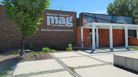
Lacombe
Blackfalds
Whitehorse — Three Hills
Whitehorse — Saint-Paul-de-Montminy
Whitehorse — Rivière-Rouge
Whitehorse — Gold Bridge
Whitehorse — Charlesbourg
Whitehorse — Le Bois-Clair
Whitehorse — McRae
Whitehorse — Sunnyside
Whitehorse — Yukon Territory
Whitehorse — La Romaine
Whitehorse — Prescott
Whitehorse — Parry Sound
Whitehorse — Echo Bay
Whitehorse — Esther
Whitehorse — Cascade
Whitehorse — Souris
Whitehorse — Coquitlam
Whitehorse — Canora
Whitehorse — Cow Bay
Teslin
Swift River
Watson Lake
Fort Nelson
Charlie Lake
Fort Saint John
Baldonnel
Taylor
Dawson Creek
Pouce Coupe
Demmitt
Hythe
Beaverlodge
Wembley
Clairmont
Calais
Valleyview
Whitecourt
Blue Ridge
Mayerthorpe
Rochfort Bridge
Sangudo
Cherhill
Onoway
Stony Plain
Spruce Grove
St. Albert
Acheson
Nisku
Nisku
Leduc
Ponoka
Lacombe
Blackfalds
Whitehorse — Red Deer distance, route on the map
Distance by car
Distance between Whitehorse, Yukon Territory, Canada and Red Deer, Alberta, Canada by car is — km, or miles. To travel this distance by car, you need minute, or h.
Route on the map, driving directions
Car route Whitehorse — Red Deer was created automatically. The road on the map is shown as a blue line. By moving the markers, you can create a new route through the points you need.
Passing cities through which the car route passes: MacRae, Teslin, Swift River, Watson Lake, Fort Nelson, Charlie Lake, Fort Saint John, Baldonnel, Taylor, Dawson Creek, Pouce Coupe, Demmitt, Hythe, Beaverlodge, Wembley, Clairmont, Calais, Valleyview, Whitecourt, Blue Ridge, Mayerthorpe, Rochfort Bridge, Sangudo, Cherhill, Onoway, Stony Plain, Spruce Grove, St. Albert, Acheson, Nisku, Nisku, Leduc, Ponoka, Lacombe, Blackfalds.
Distance by plane
If you decide to take a trip Whitehorse Red Deer by plane, then you have to fly the distance — 1596 km or 990 miles. It is marked on the map with a gray line (between two points in a straight line).
Flight time
Estimated flight time Whitehorse Red Deer by plane at cruising speed 750 km / h will be — 2 h. and 7 min.
Direction of movement
Canada, Whitehorse — right-hand traffic. Canada, Red Deer — right-hand traffic.
Difference in time
Whitehorse and Red Deer are in different time zones. The time difference is 1 hour (UTC -7 America/Vancouver, UTC -6 America/Edmonton).
Interesting Facts
Information on alternative ways to get to your destination.
The length of this distance is about 4.0% of the total length of the equator.
The percentage of the population is clearly shown in the graph:
Whitehorse — 23,272 (less by 50,323), Red Deer — 73,595 residents.
The cost of travel
Calculate the cost of the trip yourself using the fuel consumption calculator, changing the data in the table.