Las Vegas — Sayreville
Las Vegas — Nicholls
Las Vegas — Peshtigo
Las Vegas — Walterville
Las Vegas — Chappells
Las Vegas — Lucan
Las Vegas — Concordville
Las Vegas — League City
Las Vegas — Cross Timbers
Las Vegas — Palomas
Las Vegas — Dupuyer
Las Vegas — Cherry Hill
Las Vegas — Pembroke Pines
Las Vegas — Glen Easton
Las Vegas — Mayville
Las Vegas — Seldovia
Las Vegas — Reardan
Las Vegas — Saint Albans City
Las Vegas — Waynetown
Mesquite
Saint George
Washington
Toquerville
Cedar City
Enoch
Parowan
Kanosh
Meadow
Scipio
Levan
Nephi
Mona
Santaquin
Payson
Spanish Fork
Springville
Provo
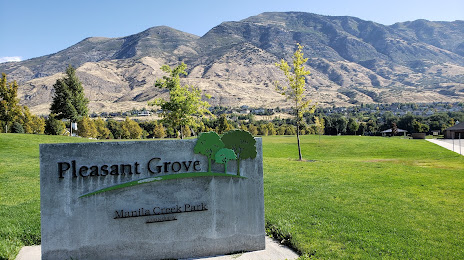
Orem
Lindon
Las Vegas — Sayreville
Las Vegas — Nicholls
Las Vegas — Peshtigo
Las Vegas — Walterville
Las Vegas — Chappells
Las Vegas — Lucan
Las Vegas — Concordville
Las Vegas — League City
Las Vegas — Cross Timbers
Las Vegas — Palomas
Las Vegas — Dupuyer
Las Vegas — Cherry Hill
Las Vegas — Pembroke Pines
Las Vegas — Glen Easton
Las Vegas — Mayville
Las Vegas — Seldovia
Las Vegas — Reardan
Las Vegas — Saint Albans City
Las Vegas — Waynetown
Mesquite
Saint George
Washington
Toquerville
Cedar City
Enoch
Parowan
Kanosh
Meadow
Scipio
Levan
Nephi
Mona
Santaquin
Payson
Spanish Fork
Springville
Provo
Orem
Lindon
Las Vegas — American Fork distance, route on the map
Distance by car
Distance between Las Vegas, Nevada, United States and American Fork, Utah, United States by car is — km, or miles. To travel this distance by car, you need minute, or h.
Route on the map, driving directions
Car route Las Vegas — American Fork was created automatically. The road on the map is shown as a blue line. By moving the markers, you can create a new route through the points you need.
Passing cities through which the car route passes: Jackman, Mesquite, Saint George, Washington, Toquerville, Cedar City, Enoch, Parowan, Kanosh, Meadow, Scipio, Levan, Nephi, Mona, Santaquin, Payson, Spanish Fork, Springville, Provo, Orem, Lindon.
Distance by plane
If you decide to take a trip Las Vegas American Fork by plane, then you have to fly the distance — 545 km or 338 miles. It is marked on the map with a gray line (between two points in a straight line).
Flight time
Estimated flight time Las Vegas American Fork by plane at cruising speed 750 km / h will be — 43 min.
Direction of movement
United States, Las Vegas — right-hand traffic. United States, American Fork — right-hand traffic.
Difference in time
Las Vegas and American Fork are in different time zones. The time difference is 1 hour (UTC -7 America/Los_Angeles, UTC -6 America/Denver).
Interesting Facts
Information on alternative ways to get to your destination.
The length of this distance is about 1.4% of the total length of the equator.
The percentage of the population is clearly shown in the graph:
Las Vegas — 583,756, American Fork — 23,582 residents (less by 560,174).
The cost of travel
Calculate the cost of the trip yourself using the fuel consumption calculator, changing the data in the table.