
 Mikhaylovka
Dyrestuy
Mikhaylovka
Mayskiy
Novobessergenevka
Tersky District
Lesnoy
Tertezh
Kuz'minskiye Otverzhki
Mikhaylovka
Dyrestuy
Mikhaylovka
Mayskiy
Novobessergenevka
Tersky District
Lesnoy
Tertezh
Kuz'minskiye Otverzhki
Monastère Saint-Nicolas on the map, Saratov, Russian Federation
Photo
Where is located Monastère Saint-Nicolas
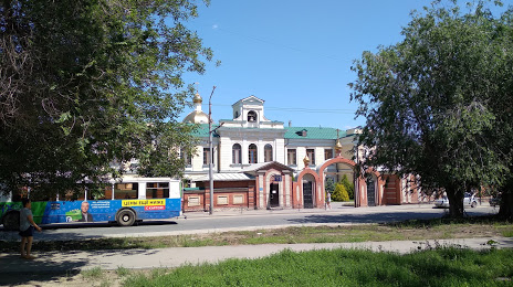
Monastère Saint-Nicolas — local attraction, which is located at Degtyarnaya Ulitsa, 26, Saratov, Saratov Oblast, 410004 and belongs to the category — monastery. Average visitor rating for this place — 4.8 (according to 85 ratings, information from open sources and relevant for 2022).
Exact location — Monastère Saint-Nicolas, marked on the map with a red marker.
You can get directions to Monastère Saint-Nicolas on the map from your location.
What else is interesting in Saratov? You can see all the sights if you go to the city page.
Coordinates
Monastère Saint-Nicolas, Russian Federation coordinates in decimal format: latitude — 51.51815287053152, longitude — 45.99128639829527. When converted to degrees, minutes, seconds Monastère Saint-Nicolas has the following coordinates: 51°31′5.35 north latitude and 45°59′28.63 east longitude.
Nearby cities
The largest cities that are located nearby:
- Engels — 8 km
- Balakovo — 132 km
- Kamyshin — 166 km
- Penza — 196 km
- Syzran — 243 km
- Saransk — 298 km
- Novokuybyshevsk — 312 km
- Tolyatti — 313 km
- Volzhskiy — 316 km
- Samara — 330 km
- Volgograd — 332 km
- Tambov — 334 km
- Ulyanovsk — 343 km
- Dimitrovgrad — 376 km
- Lipetsk — 447 km
- Arzamas — 449 km
- Voronezh — 467 km
- Zelenodolsk — 502 km
- Kazan — 509 km
Distance to the capital
Distance to the capital (Moscow) is about — 725 km.