
 Pointe-à-la-Croix
Sainte-Irène, Quebec
Marsoui
Hecla
Muskrat Dam
Wunnummin Lake
Sainte-Brigitte-de-Laval
Drayton
Mauricie
Pointe-à-la-Croix
Sainte-Irène, Quebec
Marsoui
Hecla
Muskrat Dam
Wunnummin Lake
Sainte-Brigitte-de-Laval
Drayton
Mauricie
Glenbrook Ravine Park on the map, New Westminster, Canada
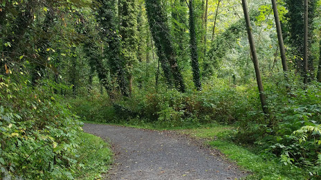
Photo
Where is located Glenbrook Ravine Park
Glenbrook Ravine Park — local attraction, which is located at 76 Jamieson Ct, New Westminster, BC V3L 5M7, Canada and belongs to the category — park. Average visitor rating for this place — 4.5 (according to 212 ratings, information from open sources and relevant for 2022).
Exact location — Glenbrook Ravine Park, marked on the map with a red marker.
You can get directions to Glenbrook Ravine Park on the map from your location.
What else is interesting in New Westminster? You can see all the sights if you go to the city page.
Coordinates
Glenbrook Ravine Park, Canada coordinates in decimal format: latitude — 49.21863796290117, longitude — -122.90140280178794. When converted to degrees, minutes, seconds Glenbrook Ravine Park has the following coordinates: 49°13′7.1 north latitude and -122°54′5.05 east longitude.
Nearby cities
The largest cities that are located nearby:
- Surrey — 5 km
- Burnaby — 8 km
- Coquitlam — 12 km
- Anmore — 13 km
- Delta — 15 km
- Richmond — 17 km
- Vancouver — 17 km
- Abbotsford — 45 km
- Victoria — 92 km
- Seattle
 (United States) — 182 km
 - Bellevue (United States) — 184 km
- Tacoma (United States) — 219 km
- Kelowna — 255 km
- Portland (United States) — 408 km
- Spokane (United States) — 443 km
- Salem (United States) — 471 km
- Eugene (United States) — 570 km
- Calgary — 647 km
- Edmonton — 783 km
Distance to the capital
Distance to the capital (Ottawa) is about — 3526 km.