
 Port Moody
Levis
Mont-Joli
Thunder Bay
Mount Pearl
Welland
Timmins
Langley
North Vancouver
Brossard
Kelowna
Blainville
Carbonear
Flin Flon
Surrey
Moncton
Aurora
Oshawa
Whitby
Port Moody
Levis
Mont-Joli
Thunder Bay
Mount Pearl
Welland
Timmins
Langley
North Vancouver
Brossard
Kelowna
Blainville
Carbonear
Flin Flon
Surrey
Moncton
Aurora
Oshawa
Whitby
Victoriaville on the map, Canada
Where is located Victoriaville
Exact location — Victoriaville, Arthabaska Regional County Municipality, Québec, Canada, marked on the map with a red marker.
Coordinates
Victoriaville, Canada coordinates in decimal format: latitude — 46.0556724, longitude — -71.9589559. When converted to degrees, minutes, seconds Victoriaville has the following coordinates: 46°3′20.42 north latitude and -71°57′32.24 east longitude.
Population
Victoriaville, Arthabaska Regional County Municipality, Québec, Canada, according to our data the population is — 34,426 residents, which is about 0.1% of the total population of the country (Canada).
Comparison of the population on the graph:
Exact time
Time zone for this location Victoriaville — UTC -4 America/Toronto. Exact time — thursday, 7 july 2024 year, 16 h. 48 minutes.
Sunrise and sunset
Victoriaville, sunrise and sunset data for a date — thursday 4.07.2024.
| Sunrise | Sunset | Day (duration) |
|---|---|---|
| 05:07 +1 minute | 20:37 -0 minutes | 15 h. 30 minutes. -1 minute |
You can control the scale of the map using the auxiliary tools to find out exactly where it is located Victoriaville. When you change the scale of the map, the width of the ruler also changes (in kilometers and miles).
Nearby cities
The largest cities that are located nearby:
- Trois-Rivières — 55 km
- Sherbrooke — 73 km
- Levis — 93 km
- Quebec — 99 km
- Longueuil — 133 km
- Montreal — 139 km
- Laval — 144 km
- Saguenay — 270 km
- Gatineau — 297 km
- Manchester
 (United States) — 341 km
 - Lowell (United States) — 382 km
- Kingston — 411 km
- Cambridge (United States) — 413 km
- Amherst (United States) — 413 km
- Boston (United States) — 415 km
- Worcester (United States) — 420 km
- Springfield (United States) — 440 km
- Providence (United States) — 470 km
- Syracuse (United States) — 474 km
Distance to neighboring capitals:
- Washington (United States) — 897 km
- Nuuk
 (Greenland) — 2368 km
 - Saint John
 (Puerto Rico) — 3116 km
 - Mexico City
 (Mexico) — 3864 km
 - Belgrade
 (Serbia) — 6772 km
 - Podgorica
 (Montenegro) — 6856 km
 - Hagåtña
 (Guam) — 12448 km
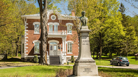
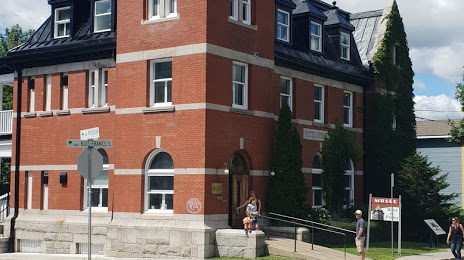
Attractions


Distance to the capital
Distance to the capital (Ottawa) is about — 299 km.