
 Pointe-à-la-Croix
Sainte-Irène, Quebec
Marsoui
Hecla
Muskrat Dam
Wunnummin Lake
Sainte-Brigitte-de-Laval
Drayton
Mauricie
Pointe-à-la-Croix
Sainte-Irène, Quebec
Marsoui
Hecla
Muskrat Dam
Wunnummin Lake
Sainte-Brigitte-de-Laval
Drayton
Mauricie
Sherriff Creek Wildlife Sanctuary on the map, Elliot Lake, Canada
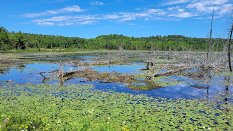
Photo
Where is located Sherriff Creek Wildlife Sanctuary
Sherriff Creek Wildlife Sanctuary — local attraction, which is located at Milliken Mine Road, Elliot Lake, ON, Canada and belongs to the category — park. Average visitor rating for this place — 4.5 (according to 13 ratings, information from open sources and relevant for 2022).
Exact location — Sherriff Creek Wildlife Sanctuary, marked on the map with a red marker.
You can get directions to Sherriff Creek Wildlife Sanctuary on the map from your location.
What else is interesting in Elliot Lake? You can see all the sights if you go to the city page.
Coordinates
Sherriff Creek Wildlife Sanctuary, Canada coordinates in decimal format: latitude — 46.4035541908175, longitude — -82.64607539217667. When converted to degrees, minutes, seconds Sherriff Creek Wildlife Sanctuary has the following coordinates: 46°24′12.8 north latitude and -82°38′45.87 east longitude.
Nearby cities
The largest cities that are located nearby:
- Barrie — 322 km
- Waterloo — 366 km
- Guelph — 368 km
- Kitchener — 372 km
- Brampton — 373 km
- Richmond Hill — 377 km
- Vaughan — 377 km
- Flint
 (United States) — 382 km
 - Cambridge — 384 km
- Markham — 385 km
- Mississauga — 392 km
- London — 393 km
- Toronto — 400 km
- Oakville — 401 km
- Whitby — 404 km
- Oshawa — 408 km
- Burlington — 409 km
- Hamilton — 413 km
- Sterling Heights (United States) — 422 km
Distance to the capital
Distance to the capital (Ottawa) is about — 549 km.