
 Sanavardo
Undilaantkari
Toncha
Pkhundavi
Tiseli
Ukeshi
Maisauri
Ghogheti
Matsevani
Sanavardo
Undilaantkari
Toncha
Pkhundavi
Tiseli
Ukeshi
Maisauri
Ghogheti
Matsevani
Sulfur baths on the map, Tbilisi, Georgia
Photo
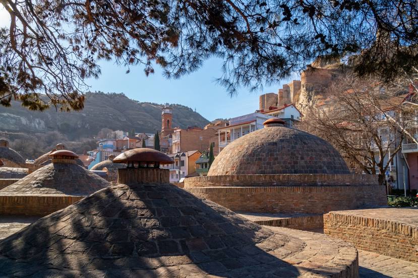
Where is located Sulfur baths
Sulfur baths — local attraction, which is located at Abano St, Tbilisi, Georgia and belongs to the category — public bath. Average visitor rating for this place — 4.6 (according to 6684 ratings, information from open sources and relevant for 2022).
Exact location — Sulfur baths, marked on the map with a red marker.
You can get directions to Sulfur baths on the map from your location.
What else is interesting in Tbilisi? You can see all the sights if you go to the city page.
Coordinates
Sulfur baths, Georgia coordinates in decimal format: latitude — 41.68808071903483, longitude — 44.811001197801666. When converted to degrees, minutes, seconds Sulfur baths has the following coordinates: 41°41′17.09 north latitude and 44°48′39.6 east longitude.
Nearby cities
The largest cities that are located nearby:
- Vanadzor
 (Armenia) — 103 km
 - Gyumri (Armenia) — 129 km
- Vladikavkaz
 (Russia) — 144 km
 - Nazran (Russia) — 166 km
- Yerevan (Armenia) — 171 km
- Kutaisi — 180 km
- Nalchik (Russia) — 217 km
- Khasavyurt (Russia) — 223 km
- Makhachkala (Russia) — 260 km
- Batumi — 260 km
- Derbent (Russia) — 291 km
- Pyatigorsk (Russia) — 292 km
- Kislovodsk (Russia) — 294 km
- Khoy
 (Iran) — 350 km
 - Cherkessk (Russia) — 351 km
- Parsabad (Iran) — 351 km
- Erzurum
 (Turkey) — 358 km
 - Marand (Iran) — 374 km
- Van (Turkey) — 376 km