
 Gilserberg
Berlin
Bordesholm
Bechtolsheim
Aub
Triptis
Heppenheim
Biblis
Angermünde
Gilserberg
Berlin
Bordesholm
Bechtolsheim
Aub
Triptis
Heppenheim
Biblis
Angermünde
Großes Heiliges Meer on the map, Hörstel, Germany
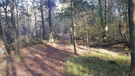
Photo
Where is located Großes Heiliges Meer
Großes Heiliges Meer — local attraction, which is located at 320 m and belongs to the category — -. Average visitor rating for this place — 4.9 (according to 7 ratings, information from open sources and relevant for 2022).
Exact location — Großes Heiliges Meer, marked on the map with a red marker.
You can get directions to Großes Heiliges Meer on the map from your location.
What else is interesting in Hörstel? You can see all the sights if you go to the city page.
Coordinates
Großes Heiliges Meer, Germany coordinates in decimal format: latitude — 52.35221223106831, longitude — 7.634006148326153. When converted to degrees, minutes, seconds Großes Heiliges Meer has the following coordinates: 52°21′7.96 north latitude and 7°38′2.42 east longitude.
Nearby cities
The largest cities that are located nearby:
- Osnabrück — 31 km
- Münster — 37 km
- Enschede
 (Netherlands) — 47 km
 - Hamm — 71 km
- Bielefeld — 71 km
- Emmen (Netherlands) — 71 km
- Recklinghausen — 80 km
- Dortmund — 87 km
- Herne — 88 km
- Gelsenkirchen — 93 km
- Bochum — 93 km
- Bottrop — 96 km
- Witten — 96 km
- Essen — 101 km
- Oberhausen — 101 km
- Paderborn — 103 km
- Hagen — 103 km
- Zwolle (Netherlands) — 104 km
- Mülheim — 108 km
Distance to the capital
Distance to the capital (Berlin) is about — 392 km.