
 Sanavardo
Undilaantkari
Toncha
Pkhundavi
Tiseli
Ukeshi
Maisauri
Ghogheti
Matsevani
Sanavardo
Undilaantkari
Toncha
Pkhundavi
Tiseli
Ukeshi
Maisauri
Ghogheti
Matsevani
Tseros Tba on the map, Borjomi, Georgia
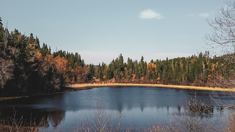
Photo
Where is located Tseros Tba
Tseros Tba — local attraction, which is located at no data and belongs to the category — -. Average visitor rating for this place — 4.3 (according to 6 ratings, information from open sources and relevant for 2022).
Exact location — Tseros Tba, marked on the map with a red marker.
You can get directions to Tseros Tba on the map from your location.
What else is interesting in Borjomi? You can see all the sights if you go to the city page.
Coordinates
Tseros Tba, Georgia coordinates in decimal format: latitude — 41.76485996687394, longitude — 43.35589509780401. When converted to degrees, minutes, seconds Tseros Tba has the following coordinates: 41°45′53.5 north latitude and 43°21′21.22 east longitude.
Nearby cities
The largest cities that are located nearby:
- Kutaisi — 72 km
- Gyumri
 (Armenia) — 122 km
 - Batumi — 147 km
- Vanadzor (Armenia) — 147 km
- Vladikavkaz
 (Russia) — 165 km
 - Nalchik (Russia) — 183 km
- Nazran (Russia) — 188 km
- Yerevan (Armenia) — 206 km
- Kislovodsk (Russia) — 236 km
- Pyatigorsk (Russia) — 246 km
- Erzurum
 (Turkey) — 279 km
 - Cherkessk (Russia) — 283 km
- Khasavyurt (Russia) — 301 km
- Trabzon (Turkey) — 320 km
- Nevinnomyssk (Russia) — 329 km
- Sochi (Russia) — 352 km
- Makhachkala (Russia) — 355 km
- Van (Turkey) — 370 km
- Stavropol (Russia) — 372 km
Distance to the capital
Distance to the capital (Tbilisi) is about — 119 km.