
 Pointe-à-la-Croix
Sainte-Irène, Quebec
Marsoui
Hecla
Muskrat Dam
Wunnummin Lake
Sainte-Brigitte-de-Laval
Drayton
Mauricie
Pointe-à-la-Croix
Sainte-Irène, Quebec
Marsoui
Hecla
Muskrat Dam
Wunnummin Lake
Sainte-Brigitte-de-Laval
Drayton
Mauricie
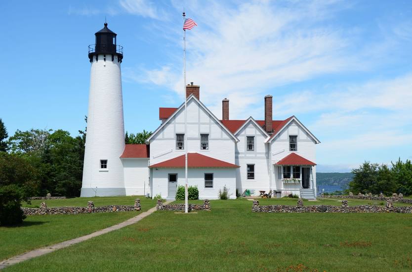
Point Iroquois Lighthouse on the map, Sault Ste. Marie, Canada
Photo
Where is located Point Iroquois Lighthouse
Point Iroquois Lighthouse — local attraction, which is located at 13042-13260 W Lakeshore Dr, Brimley, MI 49715, United States and belongs to the category — lighthouse. Average visitor rating for this place — 4.8 (according to 899 ratings, information from open sources and relevant for 2022).
Exact location — Point Iroquois Lighthouse, marked on the map with a red marker.
You can get directions to Point Iroquois Lighthouse on the map from your location.
What else is interesting in Sault Ste. Marie? You can see all the sights if you go to the city page.
Coordinates
Point Iroquois Lighthouse, Canada coordinates in decimal format: latitude — 46.484462282209265, longitude — -84.63236260188317. When converted to degrees, minutes, seconds Point Iroquois Lighthouse has the following coordinates: 46°29′4.06 north latitude and -84°37′56.51 east longitude.
Nearby cities
The largest cities that are located nearby:
- Green Bay
 (United States) — 365 km
 - Flint (United States) — 392 km
- Grand Rapids (United States) — 408 km
- Lansing (United States) — 419 km
- Barrie — 437 km
- Sterling Heights (United States) — 449 km
- Warren (United States) — 456 km
- Waterloo — 457 km
- Kitchener — 463 km
- London — 464 km
- Guelph — 465 km
- Ann Arbor (United States) — 471 km
- Detroit (United States) — 475 km
- Cambridge — 477 km
- Windsor — 477 km
- Brampton — 479 km
- Milwaukee (United States) — 481 km
- Vaughan — 487 km
- Richmond Hill — 488 km
Distance to the capital
Distance to the capital (Washington) is about — 1046 km.