
 Gilserberg
Berlin
Bordesholm
Bechtolsheim
Aub
Triptis
Heppenheim
Biblis
Angermünde
Gilserberg
Berlin
Bordesholm
Bechtolsheim
Aub
Triptis
Heppenheim
Biblis
Angermünde
Brandenburgisches Textilmuseum on the map, Forst, Germany
Photo
Where is located Brandenburgisches Textilmuseum
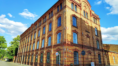
Brandenburgisches Textilmuseum — local attraction, which is located at Sorauer Str. 37, 03149 Forst (Lausitz), Germany and belongs to the category — technology museum. Average visitor rating for this place — 4.5 (according to 108 ratings, information from open sources and relevant for 2022).
Exact location — Brandenburgisches Textilmuseum, marked on the map with a red marker.
You can get directions to Brandenburgisches Textilmuseum on the map from your location.
What else is interesting in Forst? You can see all the sights if you go to the city page.
Coordinates
Brandenburgisches Textilmuseum, Germany coordinates in decimal format: latitude — 51.73893750418894, longitude — 14.645472159767802. When converted to degrees, minutes, seconds Brandenburgisches Textilmuseum has the following coordinates: 51°44′20.18 north latitude and 14°38′43.7 east longitude.
Nearby cities
The largest cities that are located nearby:
- Cottbus — 22 km
- Zielona Gora
 (Poland) — 62 km
 - Dresden — 99 km
- Gorzów Wielkopolski (Poland) — 116 km
- Berlin — 119 km
- Legnica (Poland) — 120 km
- Potsdam — 129 km
- Walbrzych (Poland) — 156 km
- Chemnitz — 157 km
- Leipzig — 163 km
- Poznań (Poland) — 170 km
- Wrocław (Poland) — 180 km
- Prague
 (Czech Republic) — 185 km
 - Szczecin (Poland) — 186 km
- Gera — 203 km
- Magdeburg — 209 km
- Kalisz (Poland) — 235 km
- Pilsen (Czech Republic) — 240 km
- Opole (Poland) — 258 km
Distance to the capital
Distance to the capital (Berlin) is about — 121 km.