
 Medvezha
Mokryany
Pidhirtsi
Prymors'k
Medvezha
Mokryany
Pidhirtsi
Prymors'k  Velyka Rudka
Nemovychi
Nyzhnya Yablun'ka
Polonychi
Berezivka
Velyka Rudka
Nemovychi
Nyzhnya Yablun'ka
Polonychi
Berezivka
Blakytne on the map, Hostomel', Ukraine
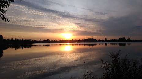
Photo
Where is located Blakytne
Blakytne — local attraction, which is located at no data and belongs to the category — -. Average visitor rating for this place — 4.4 (according to 183 ratings, information from open sources and relevant for 2022).
Exact location — Blakytne, marked on the map with a red marker.
You can get directions to Blakytne on the map from your location.
What else is interesting in Hostomel'? You can see all the sights if you go to the city page.
Coordinates
Blakytne, Ukraine coordinates in decimal format: latitude — 50.564267132207476, longitude — 30.30258899715498. When converted to degrees, minutes, seconds Blakytne has the following coordinates: 50°33′51.36 north latitude and 30°18′9.32 east longitude.
Nearby cities
The largest cities that are located nearby:
- Bila Tserkva — 86 km
- Zhytomyr — 119 km
- Chernihiv — 125 km
- Mazyr
 (Belarus) — 177 km
 - Cherkasy — 179 km
- Gomel (Belarus) — 213 km
- Kirovohrad — 271 km
- Rivne — 282 km
- Kremenchuk — 282 km
- Babruysk (Belarus) — 293 km
- Salihorsk (Belarus) — 306 km
- Sumy — 318 km
- Poltava — 326 km
- Pinsk (Belarus) — 332 km
- Balti
 (Moldova) — 357 km
 - Kryvyi Rih — 374 km
- Dniprodzerzhyns'k — 391 km
- Baranovichi (Belarus) — 400 km
- Bryansk
 (Russia) — 405 km
Distance to the capital
Distance to the capital (Kyiv) is about — 20 km.