
 Pointe-à-la-Croix
Sainte-Irène, Quebec
Marsoui
Hecla
Muskrat Dam
Wunnummin Lake
Sainte-Brigitte-de-Laval
Drayton
Mauricie
Pointe-à-la-Croix
Sainte-Irène, Quebec
Marsoui
Hecla
Muskrat Dam
Wunnummin Lake
Sainte-Brigitte-de-Laval
Drayton
Mauricie
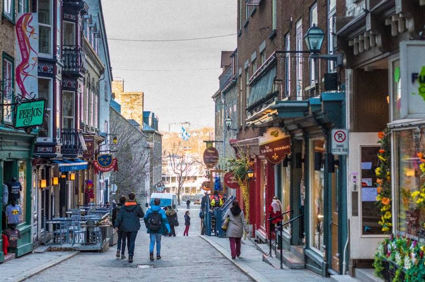
Quartier Petit Champlain on the map, Quebec, Canada
Photo
Where is located Quartier Petit Champlain
Quartier Petit Champlain — local attraction, which is located at 61 Rue du Petit Champlain, Québec, QC G1K 4H5, Canada and belongs to the category — shopping mall. Average visitor rating for this place — 4.7 (according to 4263 ratings, information from open sources and relevant for 2022).
Exact location — Quartier Petit Champlain, marked on the map with a red marker.
You can get directions to Quartier Petit Champlain on the map from your location.
What else is interesting in Quebec? You can see all the sights if you go to the city page.
Coordinates
Quartier Petit Champlain, Canada coordinates in decimal format: latitude — 46.81163363652595, longitude — -71.20339767484751. When converted to degrees, minutes, seconds Quartier Petit Champlain has the following coordinates: 46°48′41.88 north latitude and -71°12′12.23 east longitude.
Nearby cities
The largest cities that are located nearby:
- Levis — 7 km
- Trois-Rivières — 112 km
- Sherbrooke — 163 km
- Saguenay — 180 km
- Longueuil — 225 km
- Montreal — 231 km
- Laval — 232 km
- Gatineau — 375 km
- Manchester
 (United States) — 421 km
 - Lowell (United States) — 461 km
- Cambridge (United States) — 490 km
- Boston (United States) — 491 km
- Kingston — 503 km
- Amherst (United States) — 504 km
- Worcester (United States) — 504 km
- Springfield (United States) — 531 km
- Providence (United States) — 551 km
- Hartford (United States) — 570 km
- Syracuse (United States) — 574 km
Distance to the capital
Distance to the capital (Ottawa) is about — 379 km.