

Nehru Park on the map, Pilibhit, India
Photo
Where is located Nehru Park
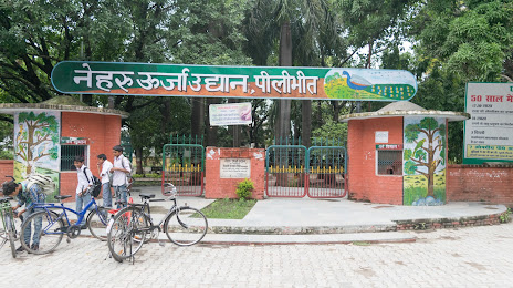
Nehru Park — local attraction, which is located at Tanakpur Rd, Ekta Nagar, Pilibhit, Uttar Pradesh 262001, India and belongs to the category — park. Average visitor rating for this place — 3.7 (according to 663 ratings, information from open sources and relevant for 2022).
Exact location — Nehru Park, marked on the map with a red marker.
You can get directions to Nehru Park on the map from your location.
What else is interesting in Pilibhit? You can see all the sights if you go to the city page.
Coordinates
Nehru Park, India coordinates in decimal format: latitude — 28.631819206459415, longitude — 79.81881202463201. When converted to degrees, minutes, seconds Nehru Park has the following coordinates: 28°37′54.55 north latitude and 79°49′7.72 east longitude.
Nearby cities
The largest cities that are located nearby:
- Bareilly — 47 km
- Haldwani — 72 km
- Shahjahanpur — 82 km
- Moradabad — 103 km
- Kashipur — 105 km
- Meerut — 208 km
- Firozabad — 213 km
- Haridwar — 215 km
- Lucknow — 226 km
- Ghaziabad — 229 km
- Roorkee — 229 km
- Noida — 235 km
- Agra — 239 km
- Faridabad — 244 km
- Mathura — 244 km
- Kanpur — 245 km
- North West Delhi — 260 km
- Saharanpur — 263 km
- Delhi — 263 km
Distance to the capital
Distance to the capital (New Delhi) is about — 255 km.